17 Magical Things to do in Death Valley National Park
The name Death Valley conjures up stark and dead and even a little bit scary, although it’s anything but. Full of unbelievable scenic drives and other-wordly features, Death Valley offers a variety of hiking trails, unique ghost towns, an educational visitor center and more than a handful of places to watch the sun come up and go down. In this article you’ll find some of the best things to do in Death Valley National Park, plus, a few tips and a map for driving from Las Vegas.
This article contains affiliate links. That means I may earn a commission, at no extra cost to you, if you buy or book something through a link share. This keep Southerner Says online and on the road. Thank you for your support.
Things To Do in Death Valley National Park
Death Valley National Park is the largest national park in the lower 48 states and contains more miles of road than any other park unit meaning it’s really spread out. The fact that some areas are very remote – and it can get very hot – it’s crucial to have a well-structured good plan for visiting and driving in the park
I’ve been to Death Valley several times now and like Yellowstone National Park, it can be a bit more complicated than other parks. Knowing what to expect and having a list of what you’d like to see and do will help maximize your time so that you don’t miss things and drive around needlessly.
Keep in mind that some of Death Valley’s roads are unpaved and unsuitable for passenger cars. Many even require 4-wheel drive and higher clearance vehicles. It’s important to know where you are going so you don’t end up on a road that you shouldn’t be on. Use a map! As long as you don’t mind gravel, my list of things to do in Death Valley National Park are doable in an ordinary passenger car. Here’s where to go.
Note: Death Valley National Park suffered major damage in August of 2023 when the park received a year’s worth of rainfall in several hours. Secondary roads were washed away and Highway 190, the main route through the park was damaged. Check nps.gov/deva for updates and Caltrans for road conditions.
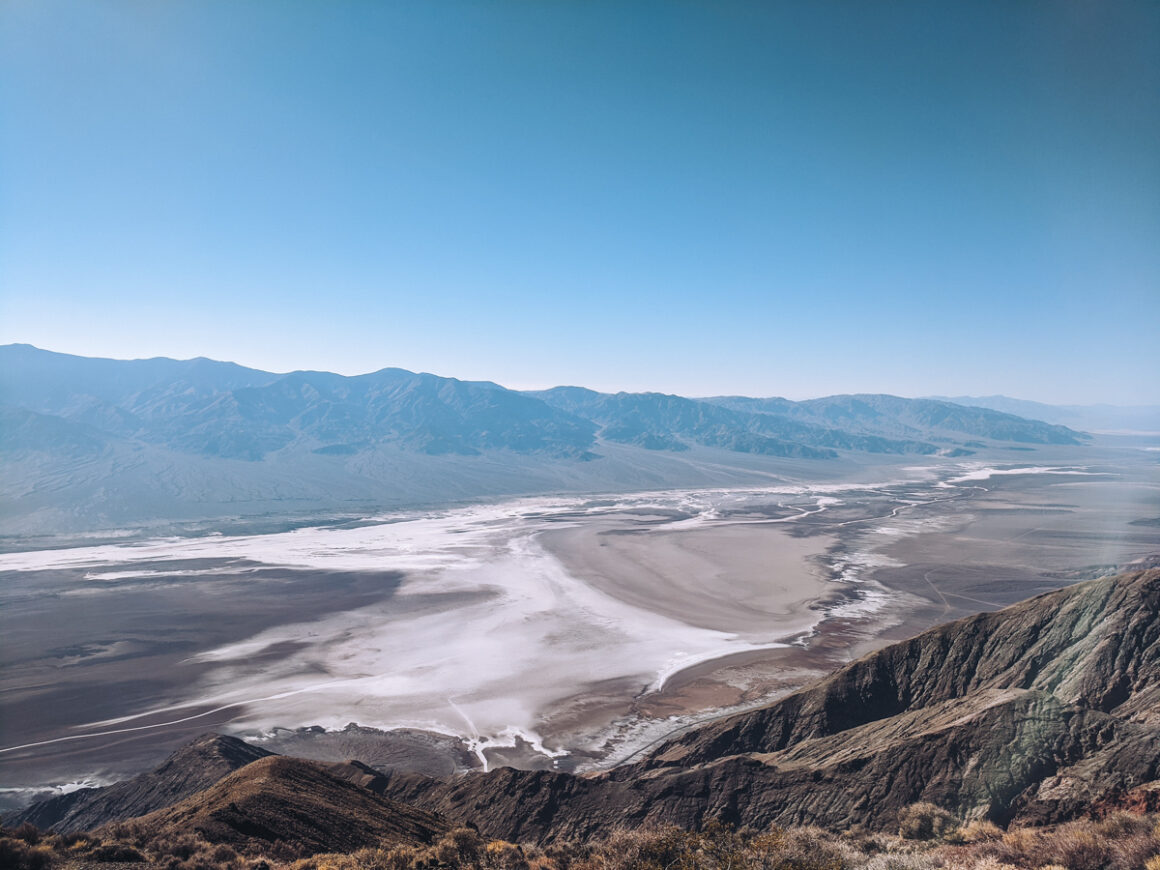
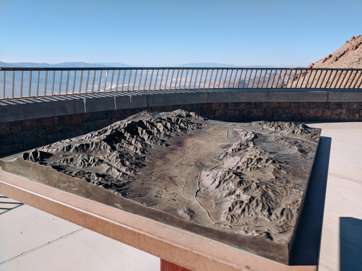
1. Dante’s View
When you entering the park on Highway 190 from Las Vegas, Dante’s View should be the first stop you make. Not only is it one of the best things to do in Death Valley National Park but it’s the ideal introduction to the park terrain and surroundings.
This viewpoint, 5,500 feet above sea level, provides a gorgeous, panoramic view of the entire area and the nearby mountain ranges and features a interesting topographical map of valley that helps you get your bearings.
Just below, lies Badwater Basin, the park’s lowest point. Across the flats to the west, is the Panamint Mountain Range with Telescope Peak, the highest point in Death Valley National Park. So, from this unique vantage is the chance to see both the lowest point in Death Valley and the highest point at the same time.
How to Get there:
Dante’s View is located on Hwy 190. Vehicles longer than 25 feet aren’t allowed on the Dante’s View Road but there’s a parking lot for trailers at the entrance to the road. Go early. The sun will be in the east and and you will be able see the area better.
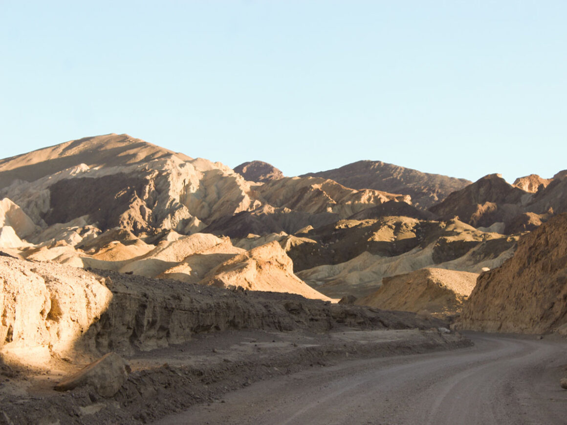
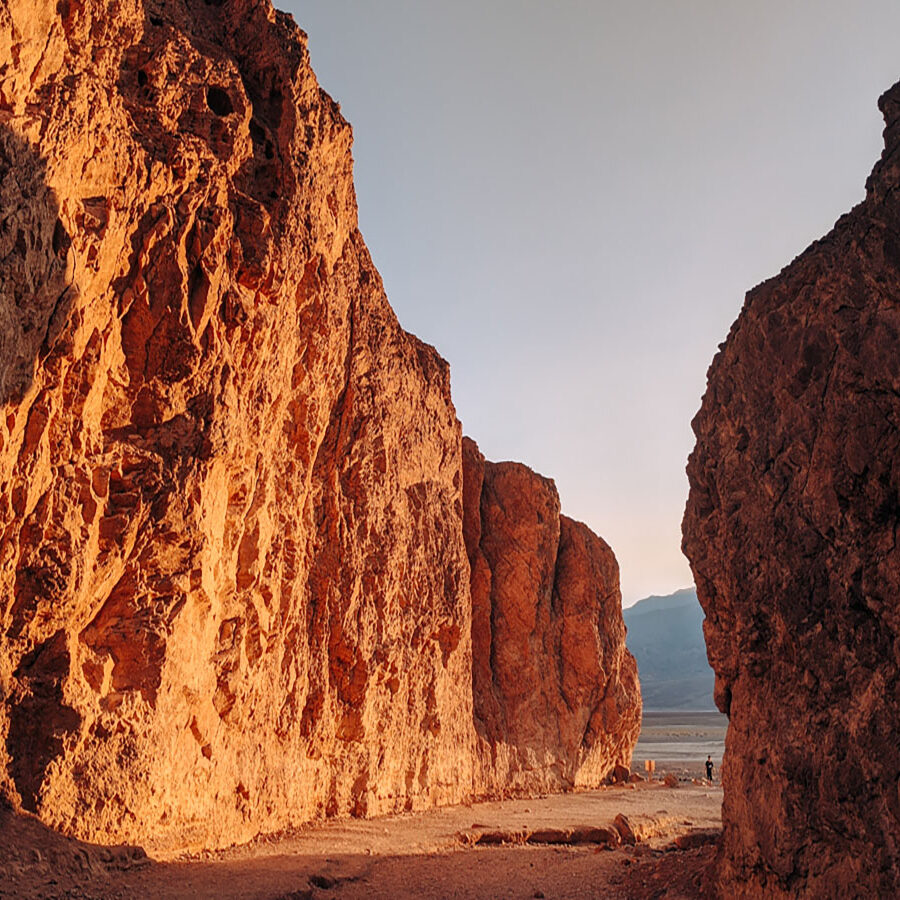
2. 20 Mule Team Canyon
Since the 1870’s, white gold – aka borax – has been mined in this mineral rich Death Valley region. The only way to transport the borax out of the valley was with wagons, pulled by horses and mules in teams of 8 and 10. Since Death Valley is hot and the terrain is so rugged, the mule teams struggled to move the the heavy borax.
To make their job a bit easier, one creative miner came up with the idea of two, 10 mule teams for hauling the product out. Voila: the 20 Mule Team name was born. Over the years, 20 mule teams carried millions of pounds of borax out of Death Valley and the name “20 Mule Team” became so popular, it still appears on Borax boxes you buy at the store.
20 Mule Team Canyon isn’t the exact route that was utilized by the mules teams on their treacherous ride out of the valley but it is similar. Driving through the canyon gives you an idea of the difficult journey the mules and drivers faced back then. Just imagine spending, at minimum, ten days with a bunch of mules, and not in your air conditioned car, in one of the hottest, darkest and most dangerous parts of the country.
How to Get There:
20 Mule Team Canyon Drive is right off Hwy 190. The road is an unpaved, 2.5 mile, one way road, that’s safe safe for cars if it hasn’t rained. The best time to visit is early in the morning or late in the afternoon
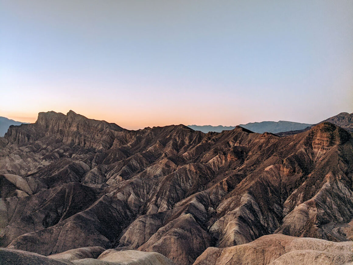
3. Zabriskie Point Sunset
In my opinion, seeing Zabriskie Point is one of the best things to do in Death Valley National Park. Located in what’s called the Amargosa Range, Zabriskie Point is made up of colorful, erosional landscapes composed of sediments from Furnace Creek Lake, a lake that dried up long before Death Valley the national park came into existence.
Many people prefer to visit at sunset, but in the evening, the light from the setting sun brings out the different colored hues as the last light bounces off the surroundings, softening the peaks and valleys with an ethereal glow.
Zabriskie Point is the perfect place to relax after a long hot day. The overlook offers a wall for sitting on but for maximum comfort, I suggest bringing a chair or two, and a snack or beverage, so you can chill and take it all in. It’s the perfect end to a Death Valley day.
How to Get There:
Zabriskie Point is located off Hwy 190. There’s a large parking lot and a gentle, uphill walk to the viewpoint. The colors are the best at sunset for that dreamy evening glow.
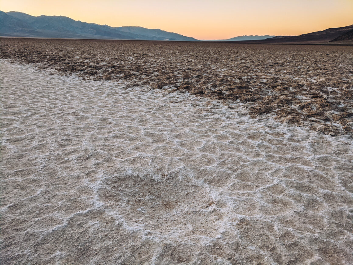
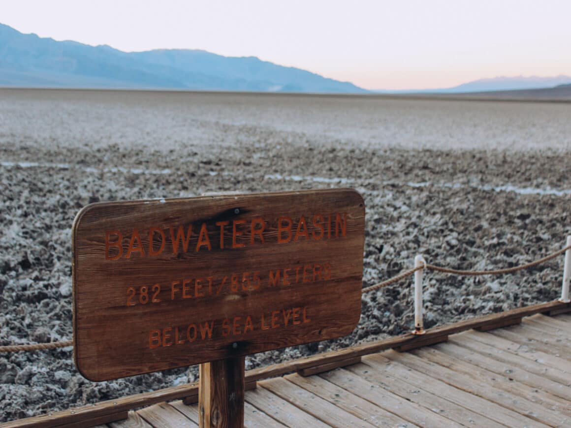
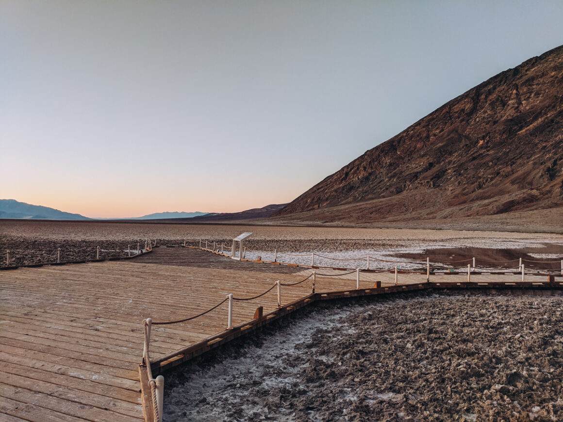
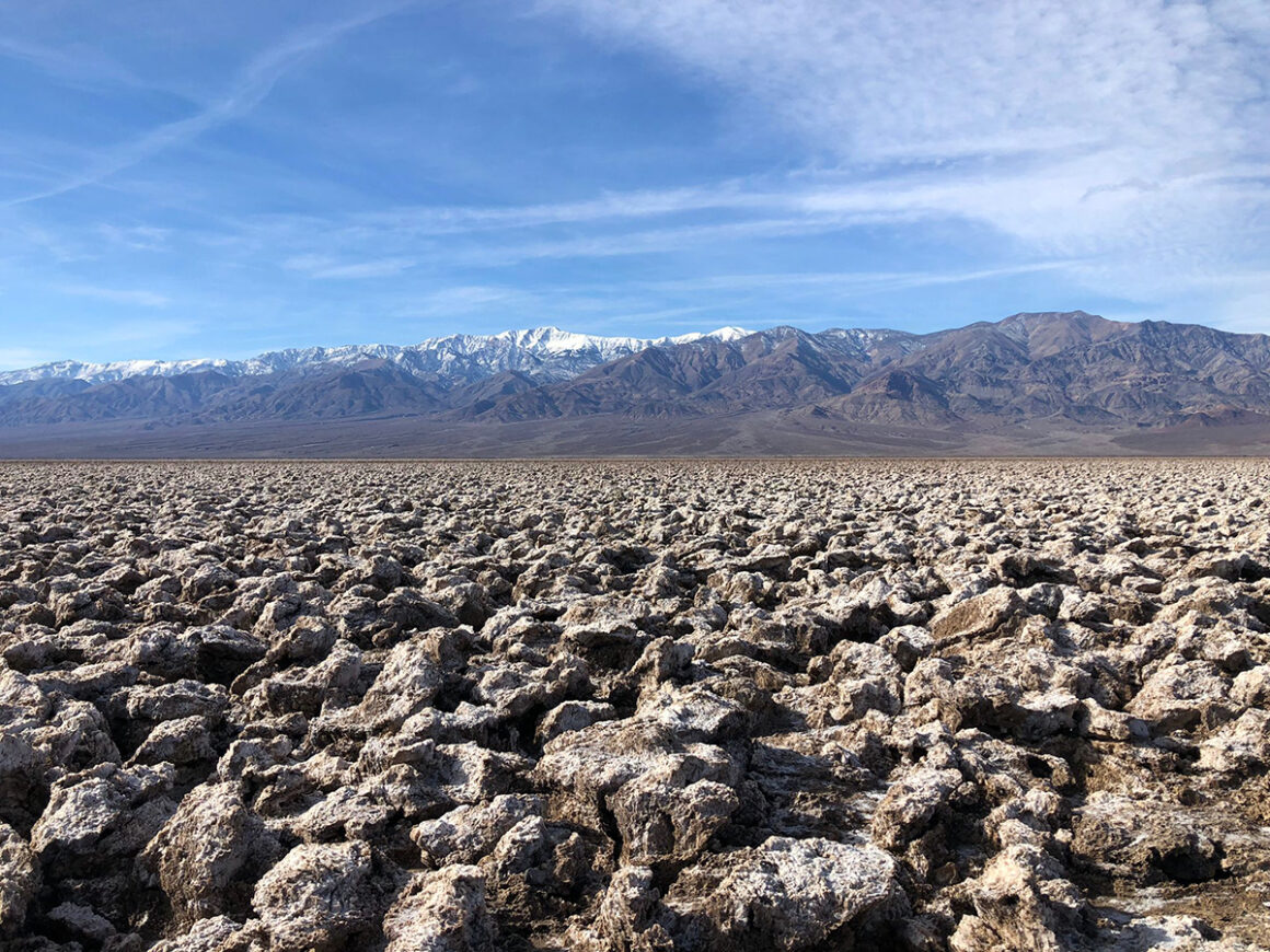
4. The Salt Flats at Badwater Basin
Created by movements in the earth’s crust, Badwater Basin is one of the most familiar sites in Death Valley National Park. At 282 feet below sea level, it’s the lowest place in the United States. In a wet climate, an area this low would be covered by water but since it’s so dry and hot in the park, when it does rain, the water evaporates and leaves behind the crusty circles and hexagons of the Badwater Salt Flats.
Southerner Says: After all the rain and flooding in the summer of 2023, a lake has once again formed in Badwater Basin. Lake Manly has reappeared after many dry years. Currently, February 2024, there is still water in the lake after winter rain.
To access the area, there are wooden boardwalks and a viewing platform but to truly appreciate the uniqueness, walking out onto the flats is a must. The further you go, the less of a crowd and the bigger the shapes in the salt are. This is also one of the top places to catch a sunrise, sunset or even a full moon since the moon lights up the white of the salt.
Southerner Says: while you’re on the viewing deck, make sure to turn around and look back towards the parking lot and the mountain behind it. There’s a sign that shows where sea level is and you’ll get a feel for what it’s like being 282 feet below sea level.
How to Get There:
Badwater Salt Flats are located on Badwater Road paved off of Hwy 190. There’s a big parking lot and restrooms onsite. Most people prefer to visit for sunrise or sunset. The salt will have a more defined appearance May through October.
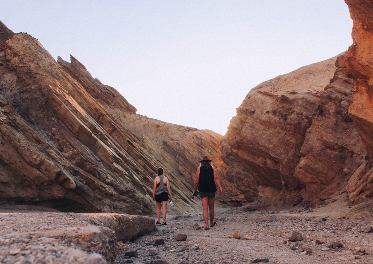
5. Golden Canyon
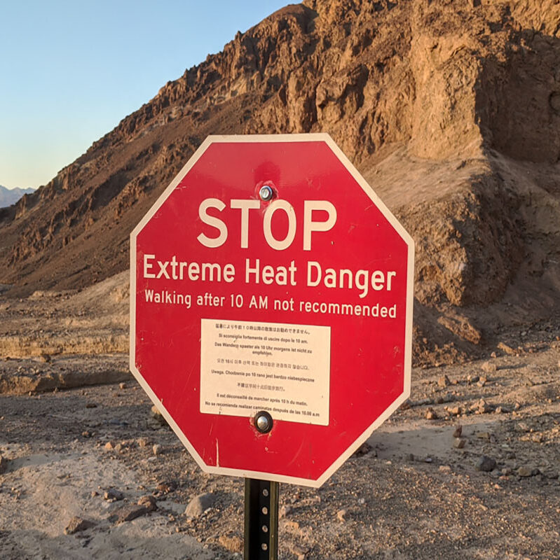
Hiking is not what you really want to do too much of in 116F degree heat but the Golden Canyon trail lured us in late one afternoon. This trail passes through a variety of unique geology and rock formations and leads to one of the Death Valley’s most vibrant features, Red Cathedral.
The complete trail is 3 miles out and back, but if you plan on visiting when it’s hot like us, you don’t have to hike all the way to Red Cathedral. Just go as far as you are comfortable and turn around, going back the the way you came. In the evening, the rocks change color with the setting sun and it looks like someone turned a light on.
How to Get There:
Golden Canyon is located on Badwater Road. There’s a parking lot with plenty of parking and a vault toilet. To hike it, go very early for sunrise or late in the afternoon and carry plenty of water.

6. Artist Drive
Artist Drive is one of the most popular scenic roads in Death Valley National Park. It’s an easy drive and perfect for the days it’s too hot to do anything else. It’s also a good option for those that can’t get around or walk so much.
This one-way paved road meanders through hills featuring a myriad of colors, so close you can reach out and touch them from the car. While there are no designated trails along the road, numerous pullouts provide convenient parking spots, allowing you to step out and explore the surrounding area on foot.
How to Get There:
Artist Drive is located off of Badwater Road. No RV’s, buses or trailers over 25 feet allowed. For the best photography, visit early in the morning while the sun is in the east or sunset.
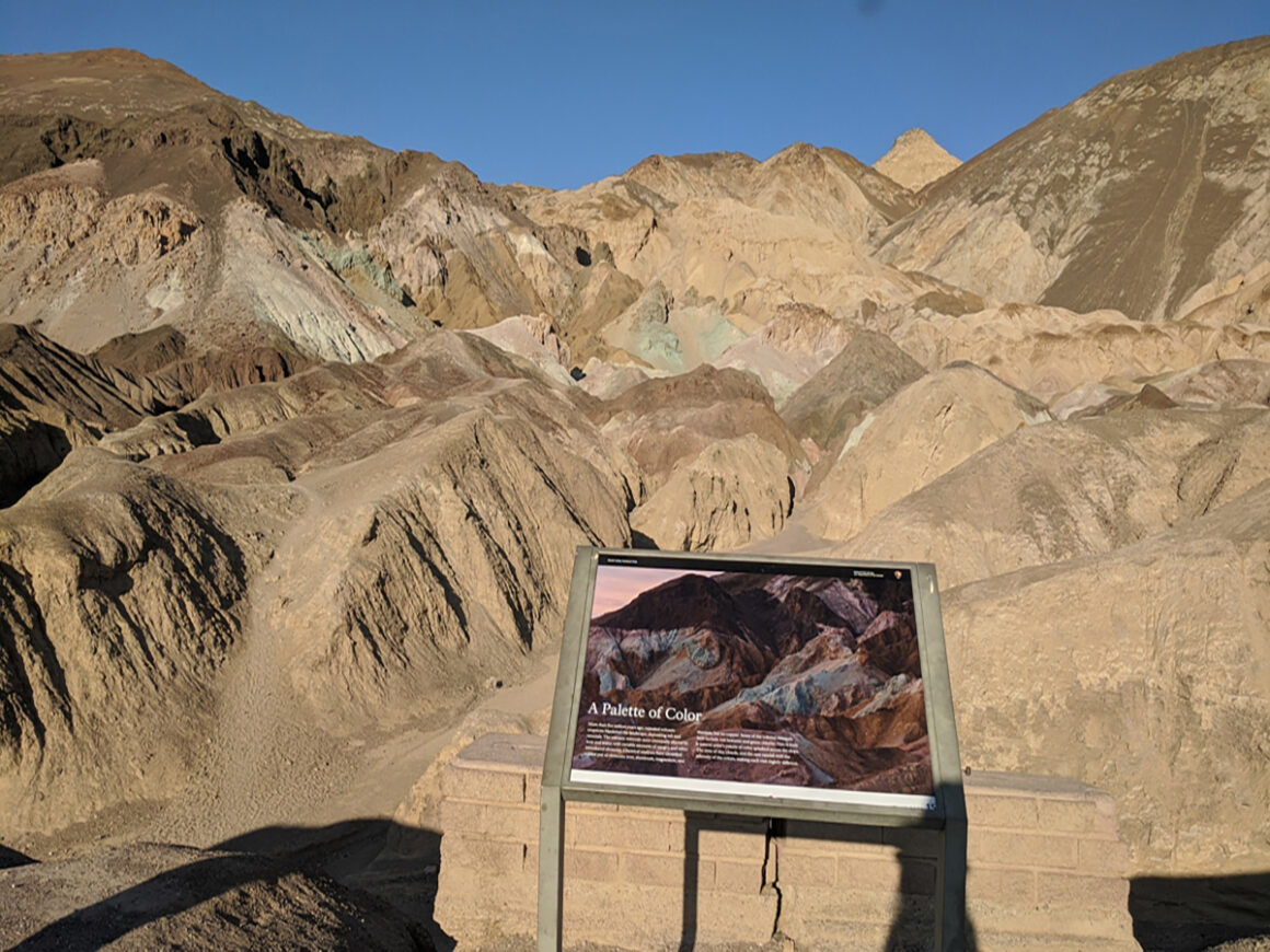
7. Artist Palette
Artist Palette is an Instagram famous overlook on Artist Drive. Here, the colors in the hills are some of the most vibrant in the entire area. The unique hues of color are due to volcanic deposits containing compounds of iron oxides and chlorite.
This gives the hills the look of an artist’s pallet or a rainbow. Depending on the time of day and the amount of recent rain, you might be able to see red, orange, yellow, blue, pink, and even green colors in the hills.
How to Get There:
The parking lot for Artist Palette is right off Artist Drive. Go early or really late in the day or after a rain for the best, most vibrant colors. Take plenty of water if you are hiking.
8. Devil’s Golf Course
No you can’t really play golf there but Devil’s Golf Course is definitely worth a stop in Death Valley National Park. This large area of the park is filled with rock salt that has been eroded by wind and rain forming rough mounds. It’s so rugged that it’s been said that “only the devil could play golf on such rough links”. Since the salt crystals expand and burst in the heat, you can literally hear the popping noises they make.
How to Get There:
Located off Badwater Road. The road and parking lot are gravel but suitable for most vehicles, even passenger cars.
Have you purchased an America the Beautiful Park Pass yet? Passes can bought at the park on online at REI.com or the USGS store. The pass can be used at over 2k interagency public land sites and saves a ton of money in the long run.
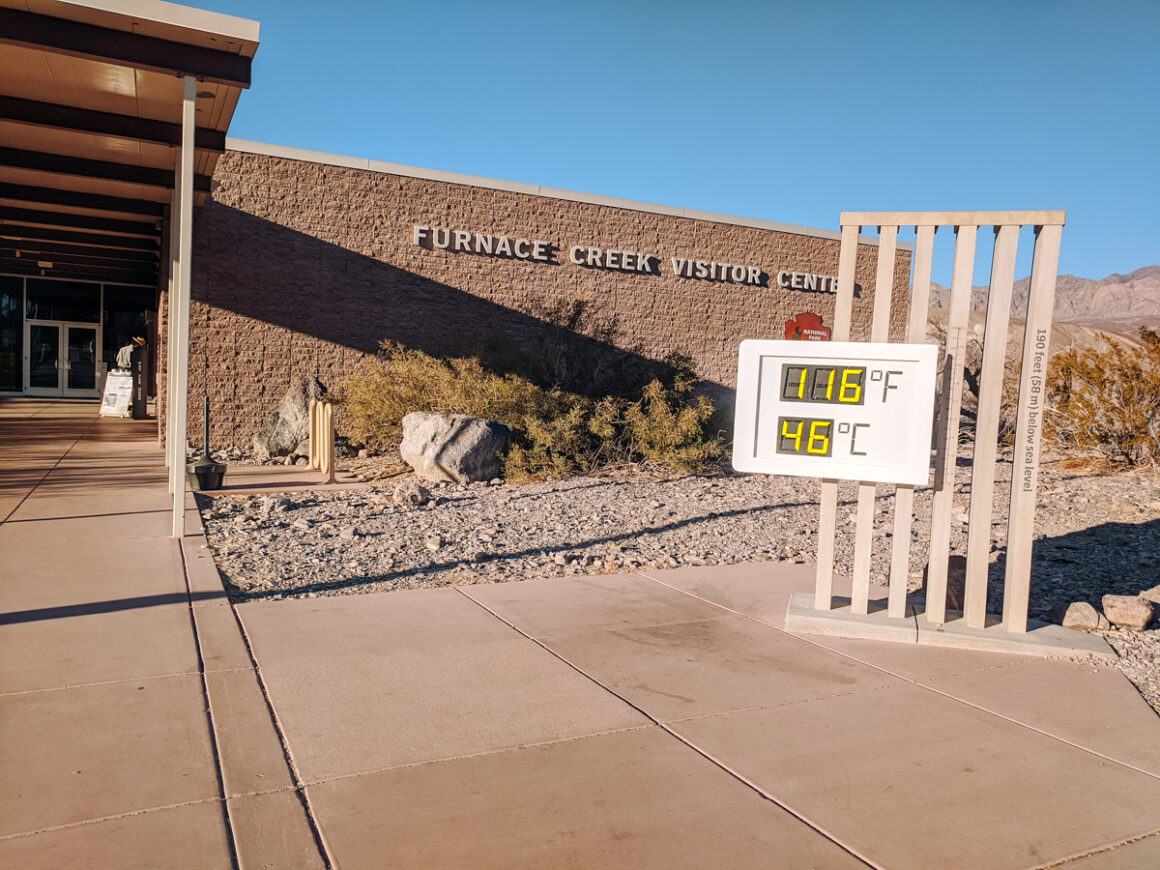
9. Furnace Creek Visitor Center
If you want to see the giant thermometer that monitors the temperature in that part of the park, then make a stop at the Furnace Creek Visitor Center. Even if you are just passing through on the way to somewhere else, it’s one of the best things to do in Death Valley National Park.
Stopping by the visitor center is a useful way to stay up to date on what’s going on in the park. Find out about any closures or park alerts, pick up a map, chat with a ranger or inquire about organized educational programs. The visitor center also has interpretive displays with informative data about the park, a book store for souvenirs, Junior Ranger activities and shaded parking.
How to Get There:
The visitor center is located in the Furnace Creek area on Hwy 190 and is open every day 8am-5pm. There are restrooms and water available.
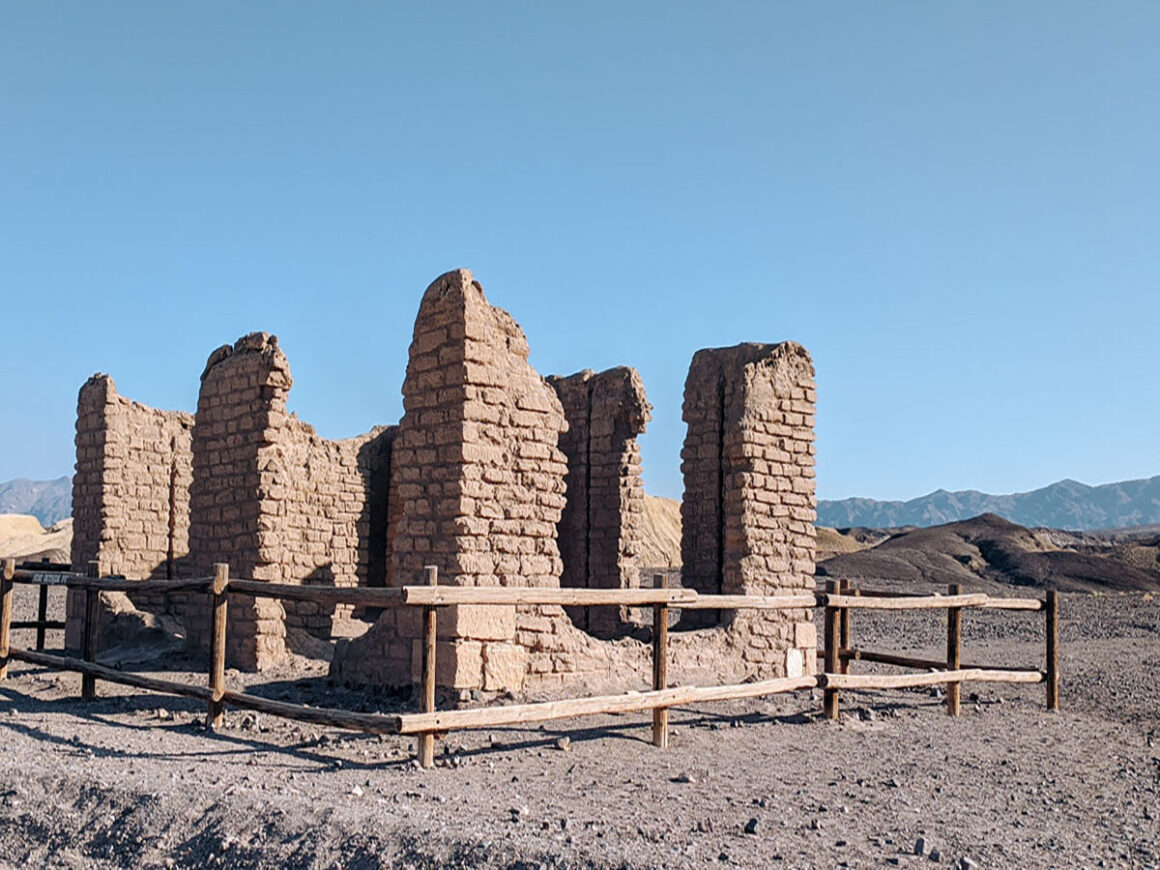
10. Harmony Borax Works
After borax was discovered, Harmony Borax Works, built in 1881, was key to the development of the Furnace Creek area. In its heyday, more than forty men worked there, processing the ore to remove borax. The Harmony is the company was responsible for the 20 Mule Team wagons. Unfortunately, the plant was short lived and closed in 1888 but a few remnants of the old buildings and mining equipment used still remain.
How to Get There:
Located on Mustard Canyon Drive off Hwy 190. The gravel road and parking lot are suitable for most vehicles
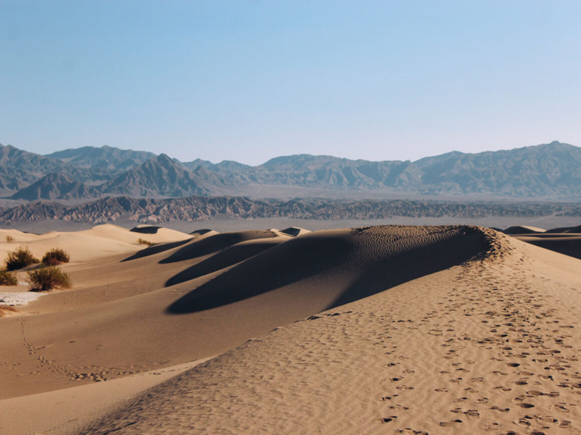
11. Mesquite Flat Sand Dunes
One of the most fun things to do in Death Valley National Park is visiting some of the sand dunes in the area. There are several sand dune areas but the easiest to reach via passenger car is Mesquite Flat Sand Dunes.
The Mesquite Flat Sand Dunes were formed by years of constant wind eroding the rocks in Death Valley. Made up of crescent, linear, and star shaped dunes (thank you NPS). The highest dune is a 2 mile out and back hike. Although you could, it’s definitely not necessary to hike that much to enjoy the dunes and the mesmerizing views.
Star Wars fans may recognize the Mesquite Dunes as the dunes of Tatooine. And while you probably won’t see any droids in the area, if you visit in the early morning, you might spot a sidewinder rattlesnake that overnighted in the cool sand. Thankfully, we didn’t see any.
How to Get There:
Mesquite Flats Sand Dunes is off of Hwy 190. There’s plenty of parking and there are vault toilets onsite. To avoid the heat, go early in the morning, when it’s cooler.
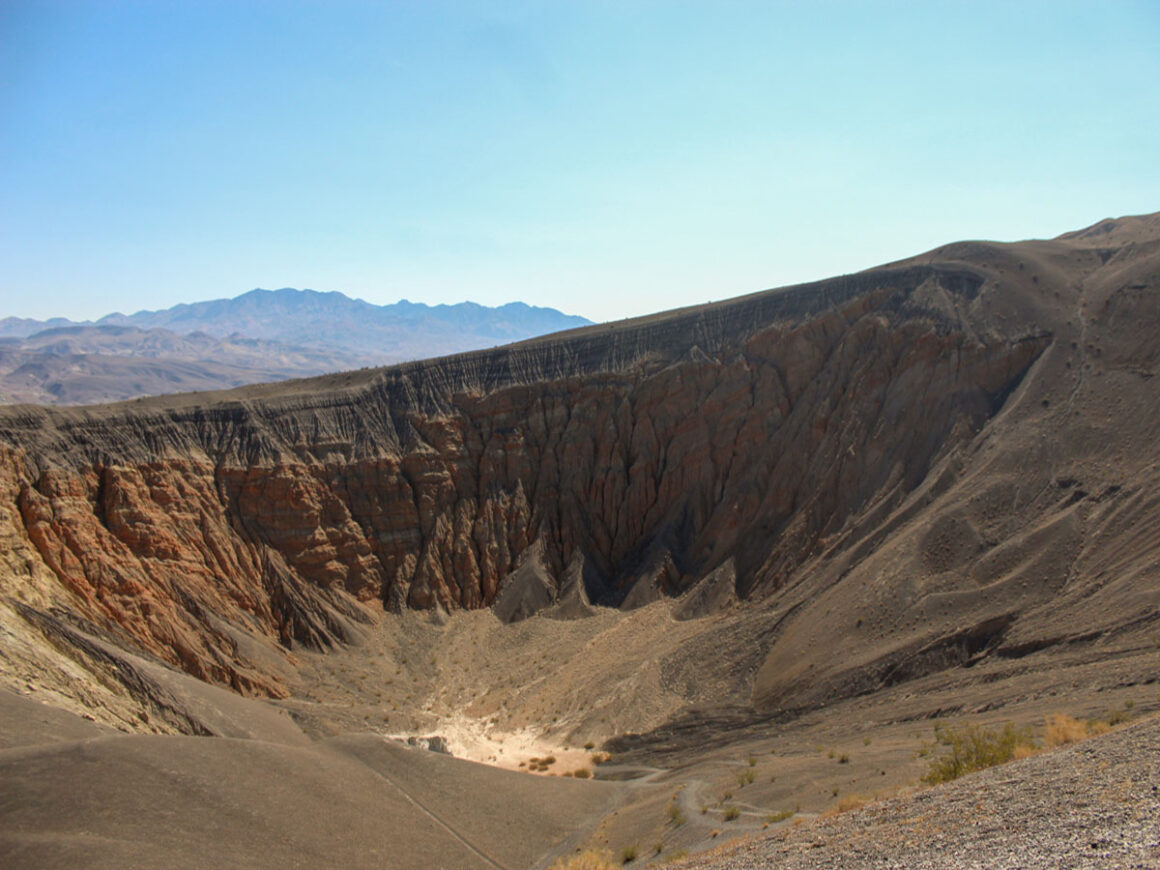
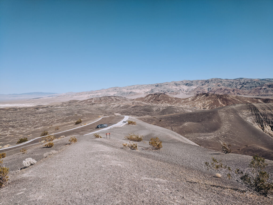
12. Ubehebe Crater
If I picked my favorite things to do in Death Valley National Park, Ubehebe Crater would be in the top three. Ubehebe Crater was formed when hot magma rose to the surface of the earth. Once it reached surface water, the steam produced caused a massive explosion that formed the hole.
Technically, the crater is six hundred feet deep and half a mile wide. That doesn’t mean that much to me in terms of size but it is large enough it’s hard to capture the accurate size without a wide lens. To confirm the depth of the crater, the park service permits visitors to descend into it on foot. Getting down there is the easier part. It’s getting back up that’s gonna be hard.
The walk to the crater is just a short uphill walk from the parking lot on a paved sidewalk but the area around the crater is full of small loose volcanic rocks so closed toe footwear is best. At the rim, there’s a 2.2 mile trail around the perimeter and plus, there are a few other smaller craters, and even a Little Hebe Crater, in walking distance.
How to Get There:
Ubehebe Crater is off of Scotty’s Castle Road (paved). This road is subject to flooding and might close during or after rain, so keep an eye on the weather. Park in the parking lot and walk up to the crater.
13. Wildrose Canyon
Currently closed due to flood damage. For a bit of off-roading experience on a paved road while in Death Valley National Park but not enough to damage your vehicle – hopefully – then Wildrose Canyon Road is it.
To do what turned into a fun loop, we drove from Stovepipe Wells to Panamint Springs to check it out this portion of the park. As we headed back towards the park from Panamint Springs on Highway 190, we turned right on Panamint Valley/Trona Wildrose Road and then left on Wildrose Road.
The road is categorized as paved and is mostly decent passable but there are sections that are bumpy and down to nothing but gravel. (note this was before the 2022 & 2023 flooding) One section in particular is very susceptible to flooding so it’s hard to maintain. It’s in this area where the pavement is the roughest.
Wildrose Canyon Road twists and winds up the mountain to a refreshing 5300 feet elevation and eventually runs into Emigrant Canyon Road, which joins back up with Highway 190 at Emigrant Campground. To drive this route in a loop like we did, it’s approximately 31 miles.
I’ve linked to a Google Map, below, for exact driving directions and other features on this things to do in Death Valley National Park.
How to Get There:
Turn off of Hwy 190 near Panamint Springs. RV’s, buses or trailers over 25 feet are not allowed on this route. The road floods easily so don’t risk it during or right after a rain.
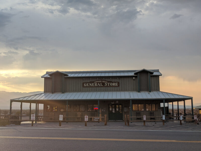
14. Wildrose Station
High on the pass, driving through Wildrose Canyon, we stopped for a picnic lunch at what used to be Wildrose Station. There’s not too much info online about this section of the park but from what I gathered, due to the convenience of a nearby spring, a privately owned stagecoach stop was established at this location.
Once the park was named a monument in 1933, the land was leased to the owner and the station continued to operate as normal. However, at some point the National Park Service decided not to renew the lease and eventually it ceased operations and the buildings were torn down.
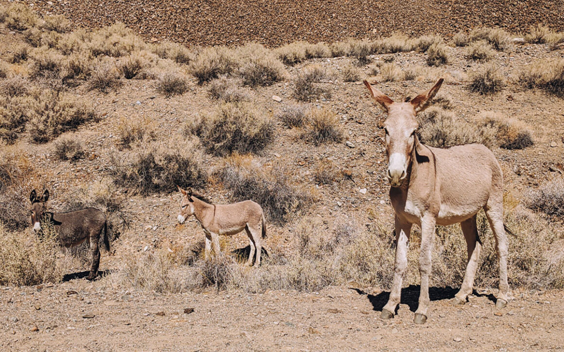
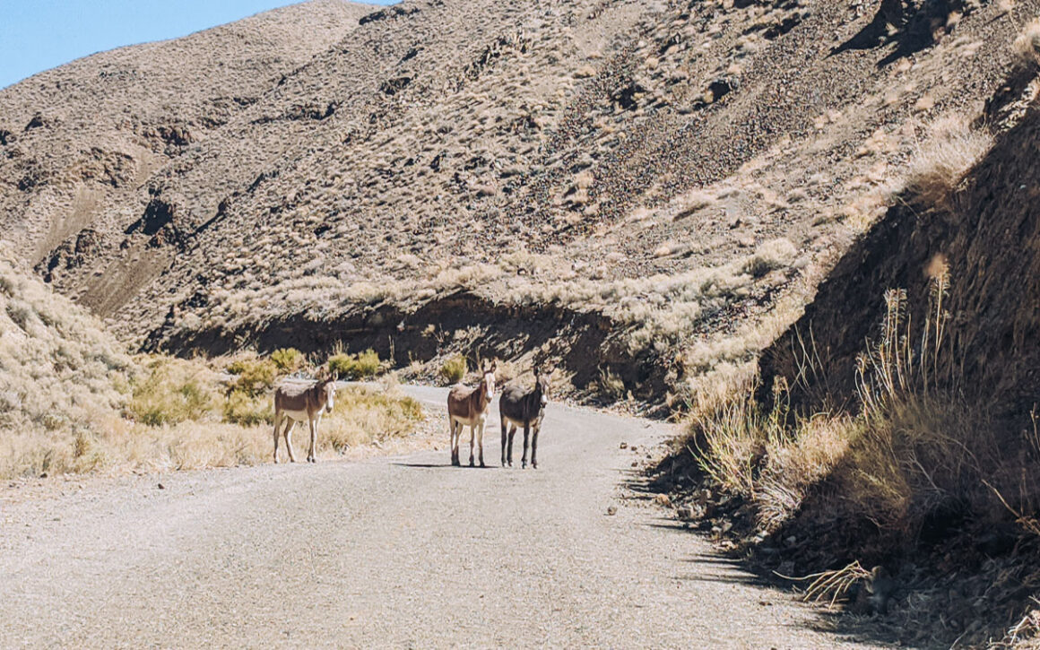
To find this spot, keep an eye out for a few remaining palm trees. The park service has added a few picnic tables on either side of the road to mark the spot. By looking around we could tell that it’s a favorite hangout for the wild burros in the park. Donkeys, or burros, offspring from the mules left over from the mining days, are common in the park.
Once we got back in the car and continued on our was, we literally ran right up on a group of them standing in the middle of the road at the next hill. No doubt it’s a favorite spot for them because of the cooler temperatures and the spring.
How to Get There:
The road gets wider at the site of the former station and you can park on the side of the road. If you do see burros remember they are wild animals so don’t feed them. Follow Leave no trace principles and take all your trash with you.
15. Wildrose Charcoal Kilns
Another piece of the interesting mining operation to visit in the Wildrose area of the park are the Wildrose Charcoal Kilns. The kilns were built in the late 1800’s by one of the mining companies as a source of fuel for their smelters – a way of removing metal from its ore. There are ten kilns still standing and are believed to be the best known remaining examples of kilns in the western states.
How to Get There:
Add a visit to the the kilns to the Emigrant Canyon Road/Wildrose Canyon drive. The kilns are located 28 miles from Highway 190 on Emigrant Canyon Road and the last 2.1 miles are unpaved but suitable for most vehicles.
Don’t forget your guidebook! For years Moon Guides have been my go-to source for all things travel. Their national park guides are super useful and written by authors who spend a lot of time in the parks they write about. I’ve linked to this helpful Death Valley National Park guide here.
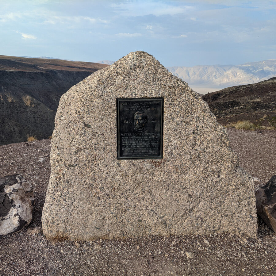
16. Father Crowley Vista Point
Death Valley National Park is full of stunning views but one of the best in the entire park is Father Crowley Vista Point. This overlook is named after a Catholic priest, Father John J. Crowley, also called the desert padre, who ministered to the people of Inyo County.
Father Crawley loved this area of California. His parish included the lowest point in the country – Death Valley and the highest – Mt. Whitney. Before it was even a park, Father Crowley frequently stopped at this viewpoint on his way to Death Valley from his home in Lone Pine, California.
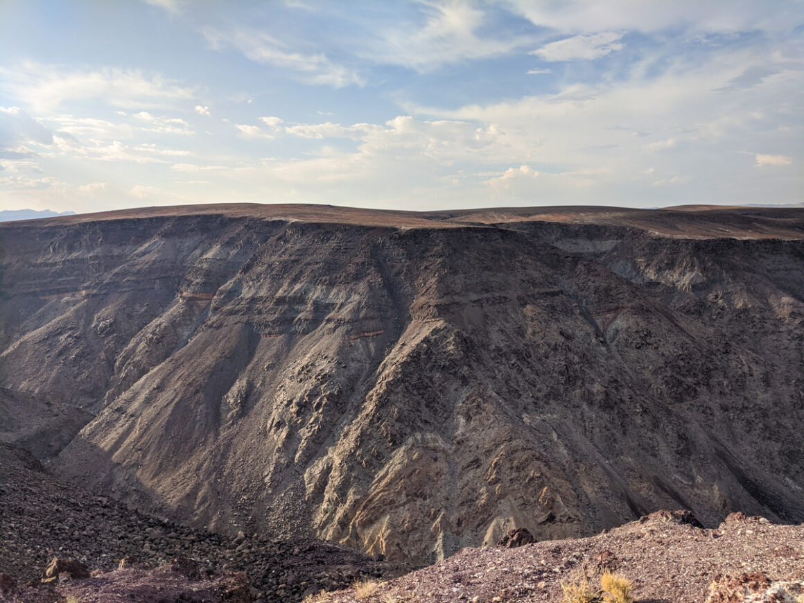
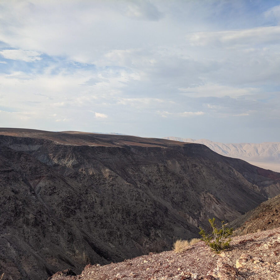
The main feature here is Rainbow Canyon, a striped canyon of various colors created by volcanic activity. In recent years, the canyon was commonly referred to as Star Wars Canyon since the military used the canyon for fighter jet practice. Sadly, after a crash in 2019, they no longer use the canyon for that purpose.
How to Get There:
Father Crowley Vista is easy to find coming from Panamint Springs on Hwy 190, in the west The overlook has plenty of parking. There are restrooms onsite and the area is also wheelchair accessible.
17. Go Stargazing
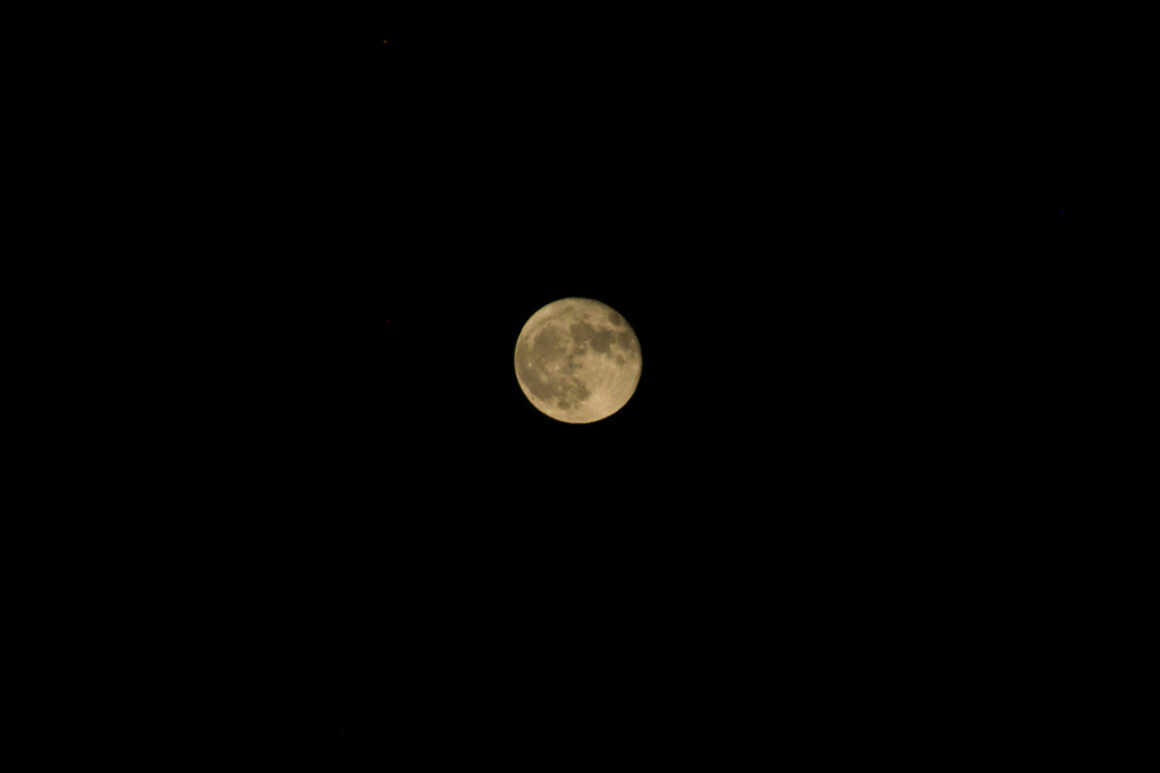
Did you know that Death Valley is a Gold Tier International Dark Sky Park? That honored designation is the highest rating of Dark Sky Parks and is only given to areas that have the darkest skies. You should be able to see millions of stars and the Milky Way with the naked eye.
Unfortunately, the only time I camped inside the park to take advantage of the dark skies, it was a full moon. However, if you visit during the busier winter season, the park holds special Dark Sky events. Check with the rangers at the Furnace Creek Visitor Center or on the park website. This year’s event is March 1-3, 2024.
Things to do in Death Valley National Park Tips
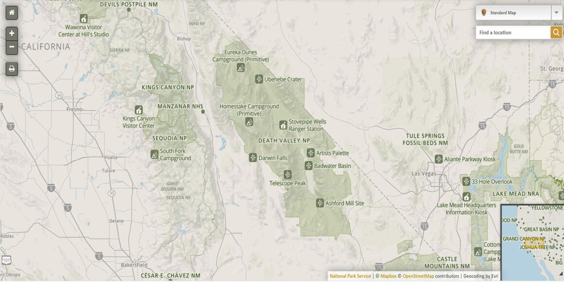
How to use this Google Map: this map has layers. Access the layers by clicking the tab in the left top. You can remove a layer you don’t want to see by simply unchecking that layer. You can also add the map to your own Google account by clicking the star at the end of the title.
Death Valley National Park FAQs
Where is Death Valley National Park?
Death Valley is located on the California-Nevada border, 214 miles northeast of Los Angeles and 126 miles northwest of Las Vegas.
Why is it called Death Valley?
The name Death Valley was coined when a group of pioneers almost died in the area in the winter of 1849-1850. When they were finally rescued, one of them turned around, looked back and said “goodbye, death valley” and the name stuck.
What’s the closest city to Death Valley National Park?
Beatty, Nevada or the Gateway to Death Valley is less than 10 miles from the east entrance of the park. If you enter or exit the park at Beatty, be sure to visit Rhyolite, a ghost town located between Beatty and the park.
When is the Best Time to Visit Death Valley?
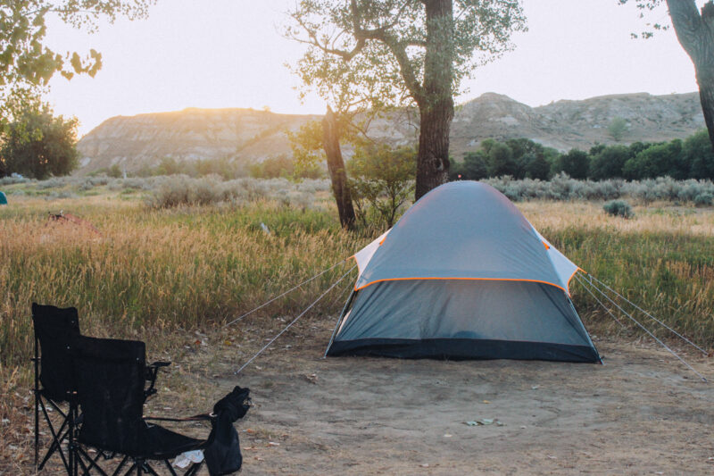
November to March is the best time to visit Death Valley. You can visit at other times but you’ll need to be well prepared. We tent camped in mid-October the first time we visited and it was still 116 degrees..
How Long Should I Spend in Death Valley National Park?
You could see everything on this list in 2 days but if you want to see the backcountry and hike more, I’d recommend at least 3 to 4 days. If you visit when it’s hot, it’s easy to get tired very quickly.
Things to do in Death Valley National Park Final Thoughts
Visiting Death Valley National Park is a truly unique experience and very much worth the effort and preparation. Since it’s so close to Los Angeles and Las Vegas, it’s easy to visit on its own or add to a longer southwestern Mojave Desert road trip with Joshua Tree National Park. However you decide to visit, I know you’ll love it as much as me.
See you on the road!