
Driving in Death Valley National Park: The Complete Guide
Death Valley National Park is one of the most extraordinary national parks in the United States and one of the most humbling. It’s the kind of place that will have you saying wow every time you turn around. But the things that make it so extraordinary are exactly what makes it so unforgiving when driving in Death Valley.
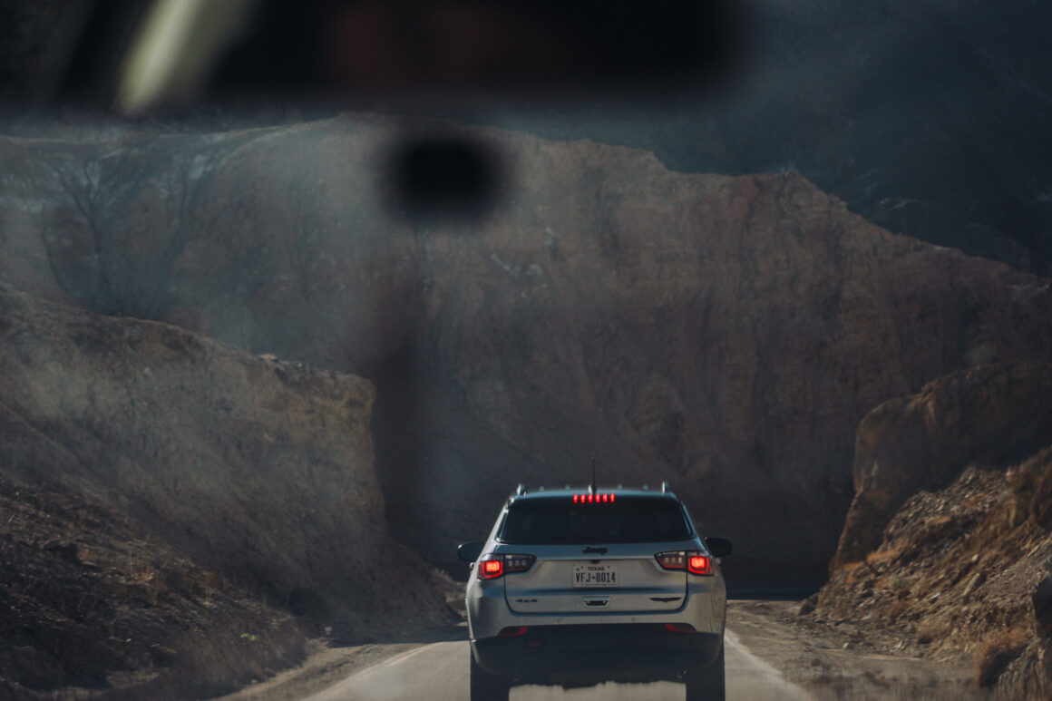
Located in the Mojave Desert, Death Valley is the lowest point in North America, the hottest place on Earth, and home to more than 1,000 miles of roads. Just driving in Death Valley can be challenging if you aren’t prepared — it’s not an ordinary scenic drive.
Driving Through Death Valley: What to Know
The remoteness, the lack of services, the heat — it all adds up fast. Not to mention you will be driving through the largest national park in the lower 48 states. These tips will help you plan ahead, avoid some common mistakes and spend more time actually enjoying this unusual national park.
1. When to Go
When you go to Death Valley matters more than you think — it’s not just about weather or vacation schedules. It’s a safety consideration.
If it’s your first visit, aim for the cooler months. Winter and early spring (December through March) are the best time. Temperatures are milder, the light is amazing and not so harsh and your car isn’t fighting the heat every mile. Spring (March through April) can also be enjoyable, especially in a wildflower year.
Late February through April is when the famous superbloom happens. It doesn’t occur every year but when it does it’s worth a trip. Check the NPS website or other Death Valley groups — there are a lot of them on Facebook — for predictions before you go.
By May the temperatures start climbing fast. And then summer is a different story. Daytime highs regularly hit 110°F or more, and the park essentially becomes an oven. Yes it’s dry heat but at those temperatures who cares. It really affects the body. You can drive Death Valley in summer — people do it all the time — it just requires more planning and more water.
Fall is the underrated window but it doesn’t really start in Death Valley until late October and even then temps can be brutal. We spent a couple of days in Death Valley mid-October one year and it was 116 F. Before you say that’s not too bad, you try sleeping in a tent on the hot ground after a hot day like that. The upside is that there aren’t many people.
2. Know How to Get There
Since Death Valley sits on the California-Nevada border it has three main entrances and how you get there depends a lot on where you’re coming from.
If you’re flying in to only visit Death Valley then I recommend flying into Las Vegas. From Harry Reid International Airport (LAS), it’s about two hours to Furnace Creek depending on which route you take — more on that in a minute.
You could also fly into Los Angeles (LAX). From the airport it’s approximately three and a half hours to Death Valley National Park. It’s doable but it’s a longer haul and depending on traffic — LA traffic is its own adventure — make sure to build in some extra time.
Road tripping from Las Vegas, the best route is Nevada Highway 160 to Pahrump — the drive itself through the Spring Mountains is part of the experience — then Death Valley Junction to Highway 190 into the park. You could also head northwest on Highway 95 to Beatty, Nevada — aka the Gateway to Death Valley — and enter the park via Highway 374.
I’ve done both and I’d recommend the Beatty route at least one way and it’s is a good overnight stop too if you’d rather break up the drive. Driving this route is the perfect loop. And it works even if you are day tripping from Las Vegas.
If you’re coming from Northern California or Yosemite, Highway 395 is one of the great American drives. Take it south to Lone Pine and Highway 136 and enter the park near Panamint Springs on Highway 190. I took a road trip from Las Vegas-Death Valley-Yosemite on 395 and it was spectacular — the Eastern Sierra doesn’t get nearly enough credit.
Southerner Says: If you’re coming in from the Nevada side, consider adding Ash Meadows National Wildlife Refuge to your route. It’s just outside the park boundary and protects a rare desert oasis that’s home to several endangered species including the Amargosa pupfish. It’s managed jointly by Fish and Wildlife and the Park Service.
3. Make Sure Your Vehicle is in Good Condition
Before you do anything else — before you choose a route or book a hotel — make sure your car is Death Valley ready.
Death Valley’s extreme heat — we’re talking 110 to 120°F — is hard on vehicles in ways drivers don’t even know about. Hot pavement, long distances and unpaved roads create conditions your Atlanta city car isn’t used to. There are actually signs on the steep grades telling you to turn off your air conditioning to keep your engine from overheating.
Checking the fluids, the battery health and the tire pressure is very important. Confirm your spare is actually usable and that you have every tool you need to change it. I learned this the hard way on one road trip to the Grand Canyon’s North Rim when we were stuck for awhile without a very small tool we needed for the lug nuts.
A compact jump box and tire inflator — I have this one I really like — and a can of Fix-a-Flat would have come in handy and worth every penny. Pack as much extra water as you can. It’s not just for drinking but for your radiator just in case and maybe some coolant too, For a full pre-trip checklist, read my Things to Check on Your Vehicle Before a Road Trip.
4. Check the Weather
If checking your vehicle is important then checking the weather is crucial. Death Valley may be one of the driest places in North America but that doesn’t mean weather or rain doesn’t happen. Strong thunderstorms, flash floods, high winds and even rare snowfall can affect road conditions fast.
The park gets less than two inches of rain a year, but when a powerful storm hits — especially during late summer monsoon — roads, washes and canyons can flood with very little warning. Entire sections of road quickly become impassable. Death Valley has sustained severe flood damage over the past few years and many roads are still in recovery.
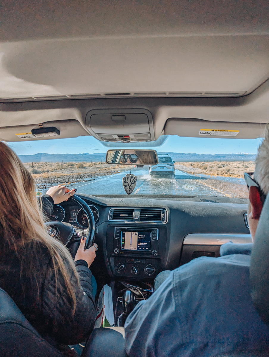
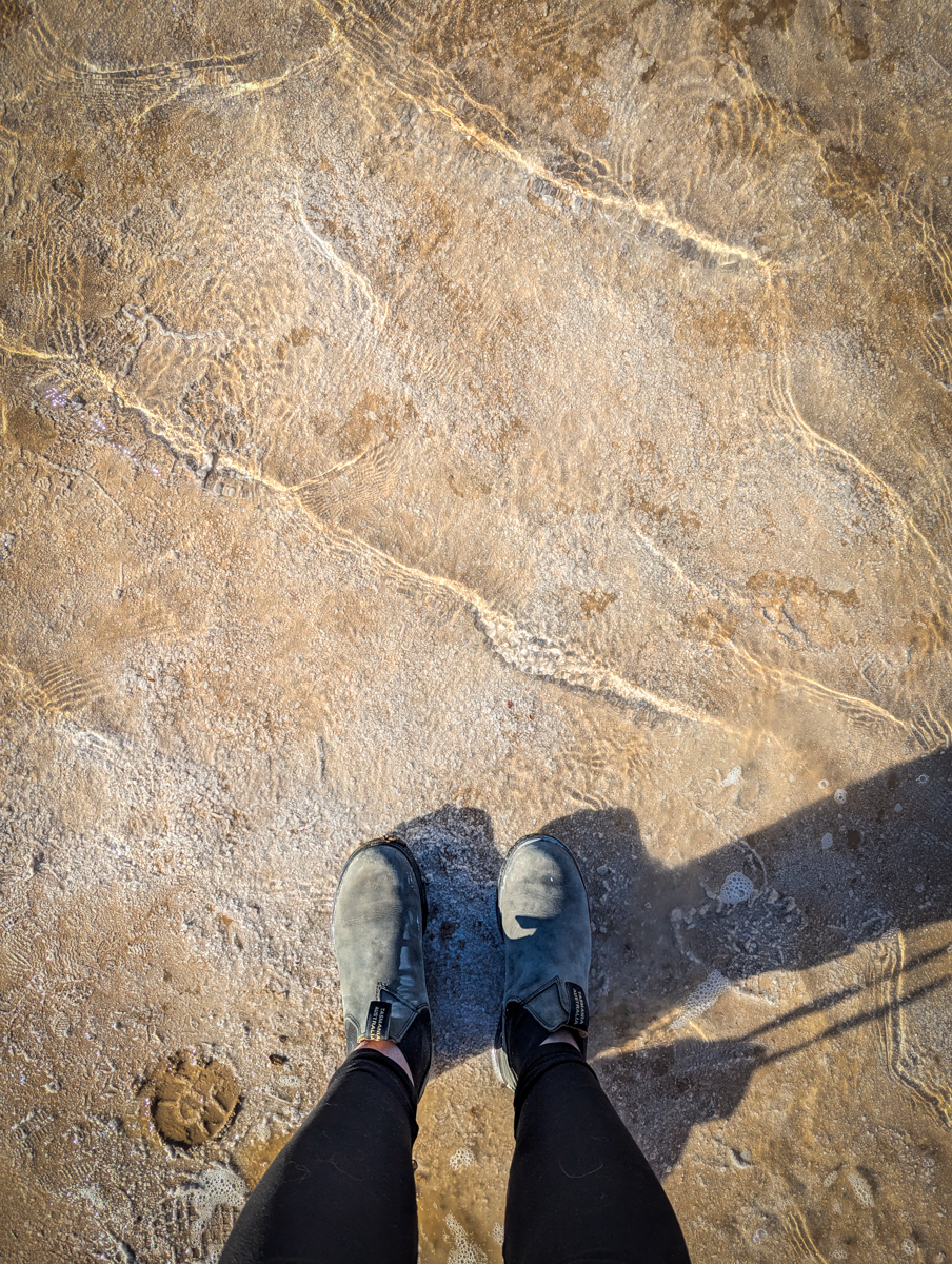
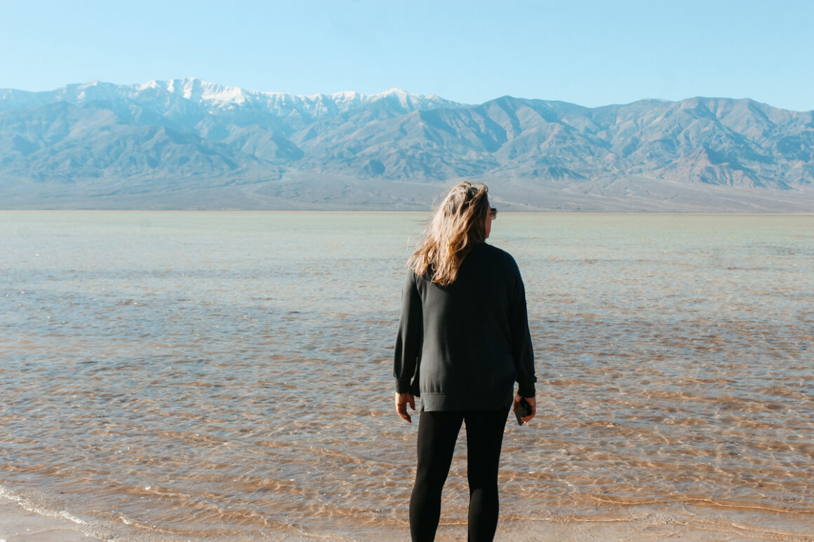
But sometimes all that rain brings good things too. In December 2025 I finally got to see Lake Manly — a temporary lake that forms at Badwater Basin after significant rainfall. If you’ve only ever seen Badwater as the dry cracked salt flat it usually is, seeing it filled with water is so surreal.
There was way more than I expected and the color was incredible. I wished I could have it all to myself since it was incredibly crowded the day we went. The water doesn’t last long and it doesn’t happen often but if the conditions are right, it’s worth going out of your way for. (Kayaking or SUP is not allowed on Lake Manly)
When driving in Death Valley, always check weather conditions before you go. Caltrans is a good place to start and double check your weather app and with rangers when you arrive if there’s a threat of bad weather. Be prepared for standing water and water on roads and in low lying areas even days after a storm.
5. Cell Service is Almost Nonexistent
Don’t count on using your phone much in Death Valley. Coverage is limited and very spotty once you get away from Highway 190. Personally I have Verizon and rarely got a signal anywhere in the park. My daughter has AT&T and she had slightly better service than me.
The area around the Furnace Creek visitor center has better cell service and there should be Wi-Fi in the building that’s available to the public.
To be safe, get your weather updates, download your maps and make any calls before you enter. If you’re planning to explore backcountry roads, a satellite messenger like the Zoleo is worth having — it lets you send texts and emails even when you’re completely off the grid.
6. Have a Map — a Real One
With over a thousand miles of roads in Death Valley — many of them unpaved — wandering onto a high-clearance or 4WD-only road in a regular passenger car is easier than you think. A map keeps that from happening.
Download one at nps.gov before you leave or grab one at the visitor center when you arrive. (You might be asked to show your America the Beautiful Pass first) The National Park Service updates these maps regularly and they’re color coded by road type — paved, graded unpaved, high-clearance and 4WD-only. That legend matters more in Death Valley than anywhere I’ve driven.
If you’re planning to get into more remote areas of the park, add the Backcountry and Wilderness Access Map to your download list. And if you’re serious about exploring off the beaten path, the National Geographic Trails Illustrated Death Valley map is worth having in the car as a backup.
7. Don’t Trust Your GPS in Death Valley
GPS is useful in most places. Death Valley is not really one of them. Not just because of lack of service but because of out-of-date information and data.
The problem is that GPS often relies on map data, and Death Valley is full of outdated data with old mining roads and closed routes that still show up in many navigation systems. If your GPS sends you down one of those roads, you could find yourself in a genuinely dangerous situation.
This isn’t hypothetical — there are real cases of visitors following bad GPS directions onto impassable roads, leading to search-and-rescue operations. Your GPS can be a good reference point but in Death Valley the physical map or the map you downloaded from nps.gov is the one you want to trust.
8. Let Someone Know Your Plans
When you’re exploring a park as vast and remote as Death Valley, someone outside the park needs to know where you are. Share your route, where you expect to be and when you plan to be back — with a family member, a friend or even a ranger. Especially if you are alone.
It would be best to do this before you get there with the lack of phone service. Then check in when you can and always update your plans if they change. And remember even occasional contact helps. It’s peace of mind for the people who care about you and having someone who would know to come looking for you if you don’t check in.
9. Keep Your Gas Tank Full
Gas stations are fewer and farther between “out west” than what you might be used to in your home state. And in Death Valley National Park, running out of gas isn’t just inconvenient — it could turn into a safety issue since there might not be anyone else around to help.
To be extra safe: fill up before you enter the park. Inside the park, you can refuel at Panamint Springs, Furnace Creek and Stovepipe Wells. Gasoline is available at Panamint Springs Resort from 7am-9:30pm, daily and available at Furnace Creek and Stovepipe Wells 24hrs.
Of course, prices will be higher than outside the park — that’s just the reality of remote locations and parks — but it’s cheaper than a tow.
A note on Panamint Springs specifically: it sits on the western edge of the park and is easy to miss if you’re focused on the main attractions around Furnace Creek. If you’re coming in from the California side via Highway 190, stop there to top off. Plus, they have a nice little general store.
If crossing the park, don’t assume you’ll make it to Furnace Creek on fumes. With all the recent rain and road destruction, there are repairs ongoing in the park. We sat in traffic one time when they were working on Highway 190 and I would not have wanted to be there with an empty tank.
10. Know Your EV Options
More and more people are driving EVs these days and Death Valley requires a little extra planning for that.
There are free Level 2 chargers at The Oasis at Death Valley — solar powered and part of the Blink Charging Network. You’ll find two dual-port chargers at The Ranch near the ice cream shop and one dual-port charger at The Inn near the tunnel entrance.
Tesla destination chargers are also available at The Ranch. These are overnight chargers, not a quick top-off. Plan accordingly and know that on busy weekends there may be a wait. There are no Tesla Superchargers inside the park. The closest are in Beatty, Nevada and Baker and Lone Pine on the California side — charge up before you enter.
One thing that catches people off guard — cell service is so unreliable that chargers requiring a connected app to activate can be a real problem. Come in with as full a charge as possible and check PlugShare before you go.
If you’re coming from Las Vegas via Highway 95, there’s a Tesla Supercharger in Beatty at the Stagecoach Hotel — charge up there before entering the park. (The Stagecoach is worth a stop for more than just charging — read my Things to Do in Beatty for more.) Coming from Southern California via I-15, Baker has chargers too and it’s a spectacular drive into the park.
Southerner Says: A reader named Jason who works as an electrical contractor and actually did the upgrade work at Furnace Creek was kind enough to leave this detail in the comments on another Death Valley article of mine. You can’t get more firsthand than that — thanks Jason!
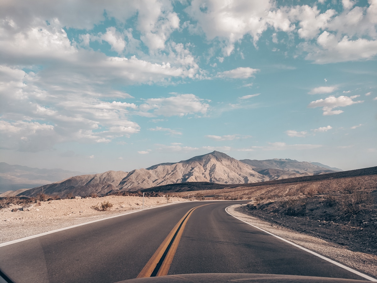
11. Drive Carefully & for the Conditions
Highway 190 takes you from the high elevation of Panamint Mountains to below sea level. It’s steep enough in places — with grades reaching 10% — that park signs actually tell you to turn off your air conditioning to keep your engine from overheating. That’s not something you see in many national parks.
Plus, roads can go from flat desert to winding mountain road faster than you expect. After rain watch for gravel and debris washed onto the road — and blowing sand can reduce visibility without much warning either.
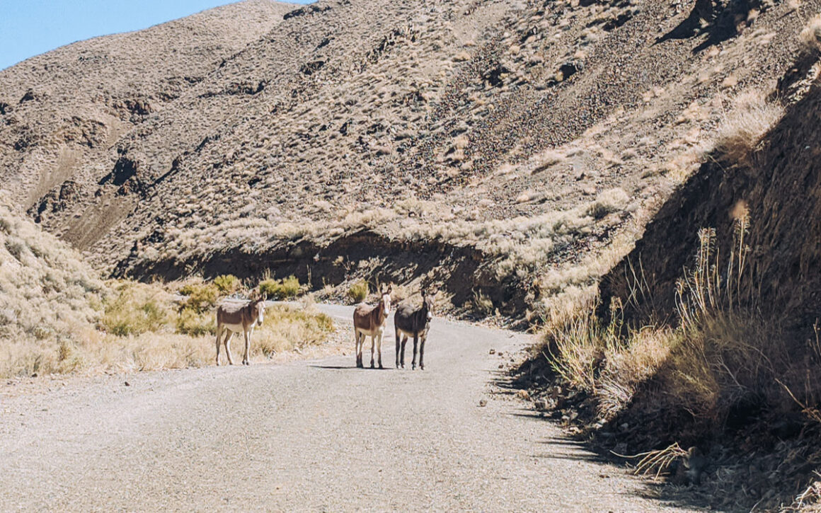
Always watch for wildlife too. This part of the desert is known for wild burros and I’ve seen them stop traffic completely — and be entirely unbothered about it. Coyotes, bighorn sheep and snakes are out there especially at dawn and dusk.
My advice: drive for what’s in front of you, not the speed limit.
12. Have an Emergency Kit
An emergency kit is a good idea on any road trip. In Death Valley, it’s non-negotiable.
You don’t need anything fancy — just enough to keep you comfortable for a few hours, or even overnight, if you break down and have to wait for help. Pack water (more than you think you need), food and snacks, basic first aid supplies, a solar or battery-powered light and something warm — a blanket, a hoodie and a beanie to keep your ears warm. Desert nights get cold fast even when the days are scorching.
Refillable water cubes or bags that pack down flat when empty are especially useful for keeping the extra water you should have in the car and so that you are never without.
13. Stay on the Established Roads
Death Valley has a lot of unpaved roads and it can be tempting to explore. But if your vehicle isn’t equipped for it — like my Jetta because in full disclosure we were driving where we probably shouldn’t have taken a car when we had that flat at Grand Canyon — going off-road could mean an expensive tow bill and a very long wait in the heat.
Most unpaved roads in the remote parts of the park are designed for high-clearance and 4WD vehicles. The terrain is rugged and it can damage your car. It can also damage the fragile desert environment, which takes decades to recover from.
Jeeps are available to rent at Furnace Creek if you want to drive in the backcountry and on roads like Titus Canyon, which remains closed due to flood damage (estimated opening Summer 2027). If you’re not experienced with off-road driving, stick to the paved roads and the well-maintained unpaved ones — especially in summer.
14. In Case of Trouble: Don’t Leave Your Car
Since cell service is extremely limited in Death Valley beyond Highway 190 if your car breaks down or you’re in an accident, you may not be able to call anyone.
In that case, always stay with your vehicle. That might be opposite of what you think you should do but the National Park Service is clear on this. Your car provides shade, visibility and a much safer place to wait than the open desert. Eventually another driver or a ranger will come. Your job is to stay put, stay hydrated and wait.
This is why having an emergency kit matters so much. This is why the extra water matters so much. You want to be comfortable waiting, not desperate.
15. Plan for the Heat — Even When You are Parked
Death Valley and the word shade do not go together — and you won’t fully appreciate the value of good shade until you’ve been there.
The Furnace Creek Visitor Center has metal shade structures you can pull under — and after driving through the open desert they feel like a gift. It’s one of the only places in the park where you can get out of the sun without hiking to higher elevation.
There’s also a kind of shady stretch along Highway 190, just before the Furnace Creek gas station and across from Sunset Campground. A row of trees and bushes planted between the road and The Ranch creates a natural barrier with shade — and there are picnic tables tucked in there. It’s a good place to stop, eat lunch and let your car cool down before heading further into the park.
Speaking of your car — there are almost no trees in the park. The only trees are a few palms and landscaping you see are on private land around the hotels. Having a windshield sunshade is very practical because parking in the open desert sun without one means climbing back into an oven every single time. It won’t help much in 120F but it’s something.
16. Use the NPS App
I’m putting this tip here for readers but also for myself because the National Park Service app has to be one of the most underused tools for visiting Death Valley — or any national park. I say that as someone who forgets about it and has missed things by not using it.
This little workhorse of an app helps you plan everything you need for a successful national park trip. Use it for self-guided tours, interactive maps, current alerts, road closures and weather conditions. Best of all it works offline — which matters a lot in a place like Death Valley National Park.
Even after visiting so many parks and my daughter is a park ranger, we still forget about it and showed up at New River Gorge in West Virginia on Bridge Day without knowing it. Bridge Day! Only the most popular event in that area that we had never heard of. The app would have told us. Learn from us.
The app is free, it’s official and it covers every national park. And you can keep up with how park units you have visited. (I also have a free national park checklist available to download) So if you aren’t already using the NPS app, Death Valley is the perfect place to start. Download it before you leave home while you still have a good signal.
Things to Do in Death Valley: What Not to Miss on Your Drive
Death Valley will blow your mind and you’ll want to see as much as you can. These are a few of the best things to do in Death Valley but if you are just driving through or only have one day the experiences might change depending on your entry point.
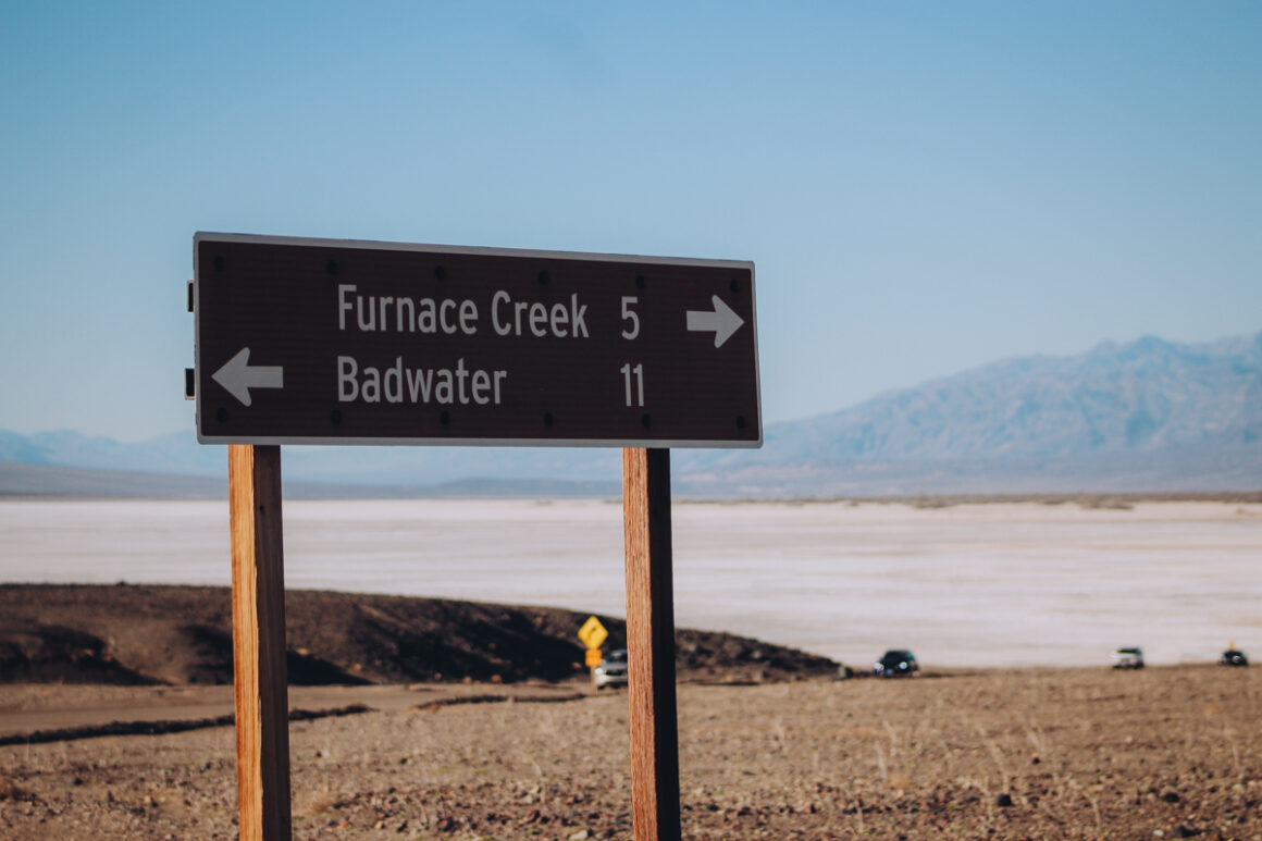
Before we get into specifics, one thing that helps enormously is getting familiar with the park’s key junctions before you go. Furnace Creek, Stovepipe Wells, Badwater Road Junction and Beatty Cutoff Junction are your main points in the park. Once you know them the park stops feeling overwhelming and starts making sense geographically.
Coming From California on Highway 190
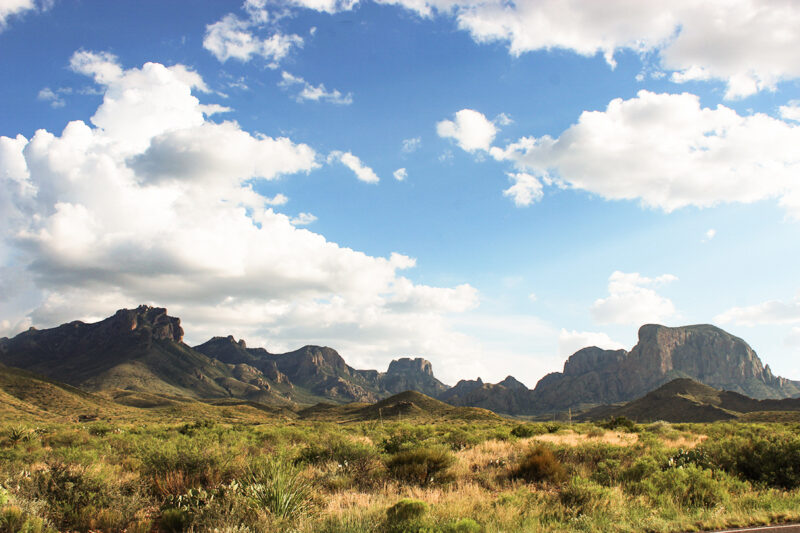
The drive itself is the first thing to do. The descent from the Panamint Mountains into the valley is one of the most dramatic stretches of road I’ve driven in any national park — and I’ve been to 40. Don’t be in a hurry on this side.
Rainbow Canyon
About 8.8 miles west of Panamint Springs, pull off for Father Crowley Vista Point. This is one of the most underrated stops in the park and the reason is simple — it’s the only place I know of in Death Valley where you stand above a canyon and look down into it.
Rainbow Canyon spreads out below you in striking bands of red, orange and volcanic color. Military jets trained here for decades flying at eye level with observers on the rim — and I’ve read sometimes close enough to see the pilot’s face. That ended after a crash in 2019 but the history and the views are still there.
Stop for gas at Panamint Springs and check out the general store. Then continue east toward Stovepipe Wells and Mesquite Flat Sand Dunes — one of the most accessible and beautiful dune fields in any national park. We ended a recent December day there and it was perfect.
Furnace Creek
This is the hub of the park. The Visitor Center, Harmony Borax Works — a quick stop with old mining machinery and a short walking path — and the start of Badwater Road are all here. Zabriskie Point is right on Highway 190 and non-negotiable regardless of which direction you’re coming from.
Heading south on Badwater Road: Artist’s Drive first — a 9 mile one way loop through multicolored volcanic formations that any passenger car handles fine. Then Devil’s Golf Course, then Badwater Basin at the end — the lowest point in North America. Walk out onto the salt flats and look up at the sea level marker on the canyon wall above you. Golden Canyon hike is also on Badwater Road. Add it if you have time.
Coming From Las Vegas
Enter Death Valley from the east and if you have the time Dante’s View is your first opportunity — it requires a detour down a separate road but the panoramic views across the valley are worth it. See the lowest point in the park to the highest.
Back on Highway 190 Zabriskie Point is next and it’s non-negotiable — short walk, enormous payoff to see some of the best colors in the park.
Continue west and head south on Badwater Road before you reach Furnace Creek. Artist’s Drive comes first — a 9 mile one way loop through multicolored volcanic formations that any passenger car handles fine. Then Devil’s Golf Course — five minutes, bizarre crystallized salt formations, worth the stop.
Badwater Basin is the highlight of this road and the reason you came. Walk out onto the salt flats and look up at the sea level marker on the canyon wall above you. It’s the lowest point in North America and it feels like it. If you are lucky, Lake Manly might still be around.
From there head north to the Furnace Creek hub for the Visitor Center, Harmony Borax Works and Zabriskie Point if you haven’t stopped yet.
Exiting Via Beatty
If you plan to exit though Beatty, Ubehebe Crater is outstanding but it’s out of the way and a time commitment. Put it on your B list and only go if you have plenty of time. Remember if visiting during the winter months the days are short. Rhyolite is a ghost town just outside Beatty and it’s an easy stop even when the sun has gone down.
The road from Beatty to Las Vegas after dark is a little more straightforward than returning from Pahrump — but know when to slow down. Wild burros roam that road freely. The speed limit is high but a motorcyclist was killed hitting a burro just two days after we drove it. That certainly stays with you.
For everything else the park has to offer — see my full guide: Things to Do in Death Valley National Park
Where to Stay in Death Valley
Hotels
Death Valley has four hotels and nine campgrounds in the park. The Oasis at Death Valley located in Furnace Creek has two options: the upscale Inn at Death Valley and the more casual, family-friendly Ranch at Death Valley.
In Stovepipe Wells, the Stovepipe Wells Village has a hotel, restaurant and saloon, a gas station and a general store – perfect for picking up essentials like ice. I have not eaten at the restaurant but it’s consistently rated highest among the restaurants in the park.
Near Panamint Springs, the Panamint Springs Resort offers their take on a western style lodging with a motel, cottages and tent cabins as well as RV and tent sites. This is the same property where the general store and gas station on the west side is located.
Camping
For year-round camping Furnace Creek Campground, managed by the National Park Service, is one of the only campgrounds open all year. The other campgrounds in the park are a mix of national park service managed and concessionaire operated campgrounds. Info can be found and reservations made at recreation.gov.
For dispersed and backcountry camping details use the Backcountry Camping Map & Rules from the park service for where to camp rules and regulations.
Southerner Says: Some campgrounds in Death Valley are first-come first-served campgrounds all year long and others, like the Furnace Creek Campground, switch to first-come first-served during the less busy season. For more general national park camping info check out my Tips for Camping in a National Park. If you feel a bit intimidated about camping without a reservation then read this First-Come First-Served article too.
FAQ
Is it okay to drive through Death Valley?
Absolutely. Driving through Death Valley is fine. Highway 190 crosses the park east to west as the Death Valley Scenic Byway. It begins about 13 miles west of Death Valley Junction and runs to the park’s western boundary. Most passenger cars handle it just fine as long as you prepare well.
How much does Death Valley cost?
$30 for cars and $15 for motorcycles. An annual pass is $55. If you have an America the Beautiful Pass, entry is free — and that pass is good at more than 2,000 public lands across the country. It’s totally worth it even with the new non-resident prices if you’re going to more than one park.
Is Death Valley National Park Always Open
Yes — Death Valley is open 24 hours a day 365 days a year. However roads and facilities within the park can close due to weather, flooding or maintenance. Always check current conditions at nps.gov before you go especially after heavy rain.
Do you need all wheel drive to drive in Death Valley National Park?
No. Even though Death Valley National Park has a high number of unpaved and gravel roads, there are plenty of road and experiences for regular passenger cars. The National Park Service’s map has a road legend to help you know which roads to avoid.
Death Valley Will Humble You — Go Anyway
With a little planning and an understanding of the conditions, driving in Death Valley is a lot less intimidating than the name suggests. As long as you: prepare your vehicle, watch the weather forecast, check road conditions, and respect the desert — you’ll spend more time enjoying Death Valley than managing a crisis.
One more thing: besides the information available on the National Park Service website, I highly recommend picking up a Death Valley guidebook before you go. Moon Travel Guides have always been my go-to for destinations and parks, and the Death Valley National Park guide is a must. It goes into more detail than any website and it fits in your glove box.
If you have questions about planning a Death Valley trip or just want to run something by someone who spends a lot of time in Nevada and the southwest — I’m just an email away. Or if you’d rather have me plan your Death Valley or southwest trip, fill out this form.
See you on the road!

Author: Lori Blalock
A girl raised in the South, Lori is the founder of Southerner Says and is a travel advisor who’s road tripped all 50 states and visited over half of the Mexican states. Passionate about national parks, public land, sunsets and good barbecue, she writes about and helps others plan memorable adventures in the U.S., Mexico and Caribbean. Georgia is home — but she’s rarely there.

I’m paranoid. I’d also carry a large cooler filled with ice or even better frozen water bottles.
That’s a good tip! I definitely think the water bottles would be better. Thank you!